The Tafuna region of Tutuila, American Samoa has a history of severe flooding due to its geographic and climatic conditions. Notable events include Tropical Cyclone Gita in 2018, which displaced over 800 people and caused $7 million in damages; the torrential rains of July-August 2014, leading to flooding and landslides; and Tropical Cyclone Heta in 2004, which resulted in $25.9 million in damages. Additionally, Tropical Cyclone Esau in 2003 caused flooding and landslides, impacting nearly 4,500 people, and resulting in $12 million in damage.
The US Army Corps of Engineers, Honolulu District, will prepare a Draft Integrated Feasibility Report and Environmental Assessment for the Tafuna Flood Risk Management Feasibility Study. The non-Federal sponsor of the project is the is the American Samoa Government, represented by the American Samoa Department of Public Works. The purpose of the study is to evaluate flooding problems and identify potential flood risk reduction alternatives within the Tafuna area on the island of Tutuila in the U.S. Territory of American Samoa.
The study area is located within a heavily populated area of Tutuila Island known as the Tafuna-Leone Plain. Properties within the Tafuna-Leone Plain include residential and non-residential structures (e.g., commercial and government buildings), main roads, drinking water wells, churches, and school facilities and are susceptible to frequent flooding.
Over time, local flooding has become more acute within the Tafuna area due to urban development and land use changes and two Flood Plain Management Services (FPMS) studies were conducted to further evaluate the Tafuna watershed, the last of which was completed in 2019 which resulted in the hydrological modeling updates to the 1994 PAS study and further refined the flood hazards in the Tafuna area.
The Non-Federal Sponsor of this Study, the American Samoa Government Department of Public Works (AS DPW) requested the USACE support to conduct the study under the Emergency Supplemental Appropriations initiative commencing the Tafuna Flood Risk Management (FRM) Study.
The Tafuna FRM Study began in May 2020 then COVID-19 travel restrictions delayed a site visit until March 2022. It was concluded from that site visit much more data would need to be collected, which was not possible in the three year timeline for the study required by USACE. An exception was requested by the study team and accepted on 23 August 2024, providing the Tafuna FRM $3 million more in funding for the study and no more than 36 months to complete a Chief’s Report. In this time, the study team completed work that extended the floodplain, including more areas likely to be affected by flooding.
The draft report will identify flood risk management opportunities to reduce flood damages and increase resilience in the community of Tafuna in the form of an Integrated Feasibility Report and Environmental Assessment projected to be released for public review early 2026. The tentative completion of the final Chief’s Report is mid-August 2027.
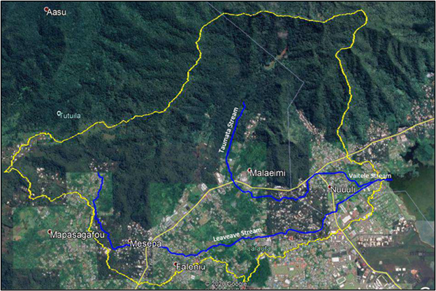
Figure 1. The study area of the Tafuna Flood Risk Management Feasibility Study.
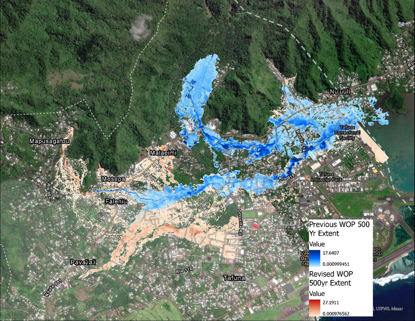
Figure 2. Previous and new extent of the floodplain. The previous extent is in blue (darker color), and the additions to the flood plain are in orange (lighter color). This study will evaluate both the blue and orange areas for flood risk.